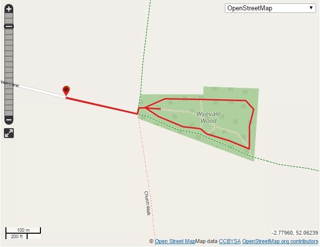
Wyevale Wood is a light, leafy, level woodland wander with lots of room to run around and play. It is low down and sheltered with wide paths suitable for off-road pushchairs. There is also a brilliant hide where you can watch the birds and plenty of pathways to explore. There is a small parking area and a short walk along a bridleway to the woods. This woodland nature reserve is only minutes from Hereford but it feels a world away.
Wyevale Wood
Distance: just under a mile (we stuck to one track, there are more to explore)
Time: 40 mins (an hour after stopping to look at the woodland wonders)
Guide
From the parking area keep following the lane until it turns into a bridleway.
Continue until you come to a junction.
Take the left hand turning and go through the metal gate on your right.
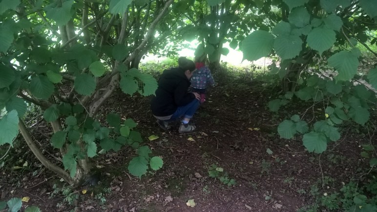
As you go through the gate you enter a small clearing with a bird hide and paths going in several directions. We took the path to the left.
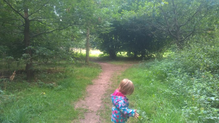
This trail takes you into a shady woodland tunnel with young trees forming arches over your head.
Then it opens up as the sun streams through the taller trees. Take a moment to look up at the beautiful leafy patterns above your head.
Our adventurer loved looking at the different leaves and seeds along the edges of the trail.
We also explored inside a den made for us by nature! There were some great sticks, twigs and nuts on the floor in here. Why not bring a blanket and set up woodland home to rest little legs?
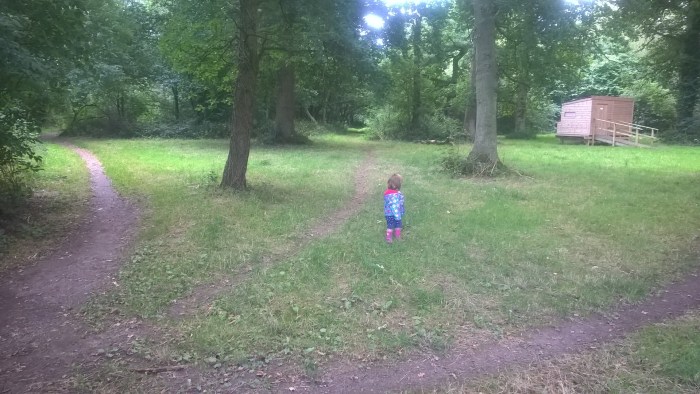
Next the trail led us into an open area with a gate in the far corner and two tracks leading away. We took the left hand track which was a bit bumpier than the right hand track (better for pushchairs).
This soon joined back up with the smoother trail where we continued left, around the reserve.
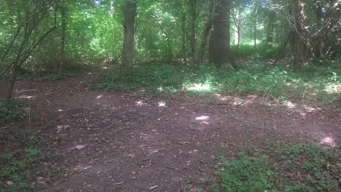
We wandered through the woods, past another entrance gate and a track leading off to the right into the middle of the woods.
Soon we wandered back in to the clearing with the bird hide where we had begun – we couldn’t resist a look inside! Why not bring binoculars so your adventurer can get a closer look?
After we had finished a bit of bird spotting we headed back out of the gate and along the bridleway to the parking area.
If you are after a longer walk then you can continue along the bridleway a short distance to Drovers Wood, managed by The Woodland Trust – see map below.
Use this map to guide you on your way. Click to enlarge.
Directions: Leaving Hereford on the A438 pass Wyevale Garden Centre on your right and take the left turn onto Breinton Lane, signposted Breinton. Take the first left hand turn, signposted Green Lane. Continue until you reach the parking area on your right.
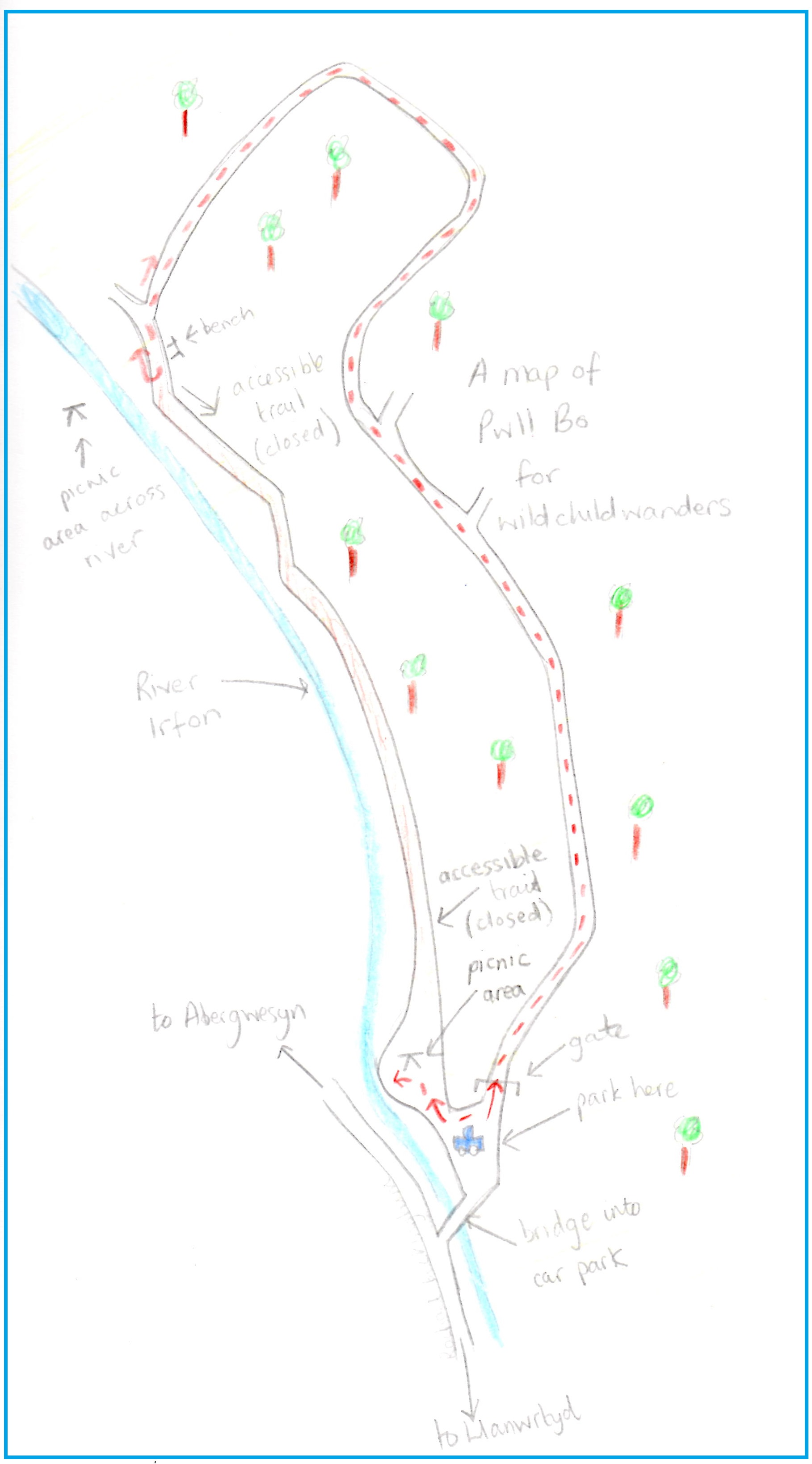
Pwll Bo is a gently sloping forestry wander with well maintained stony tracks. It is sheltered in the trees; cool and shady on a hot day. There is plenty of off-road parking and a wonderful riverside picnic area with benches and bbq spots. This could be a circular trail however when we visited the accessible path that runs next to the river was closed due to a landslide, so we wandered along the forestry track and back again.
Pwll Bo
Distance: just over 1 and a 1/2 miles
Time: About an hour (it took us just over 1 hr 30 mins with our adventurer).
Guide
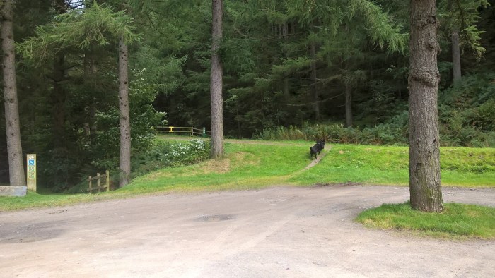
From the car park take the upper track heading left into the forestry.
There are some good information signs to help you on your way.
Go through a gate and carry on up the gentle hill.
Listen out for the small waterfall to the right of the track.
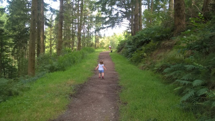
The trail meanders uphill and then comes to a junction. Take the left hand fork.
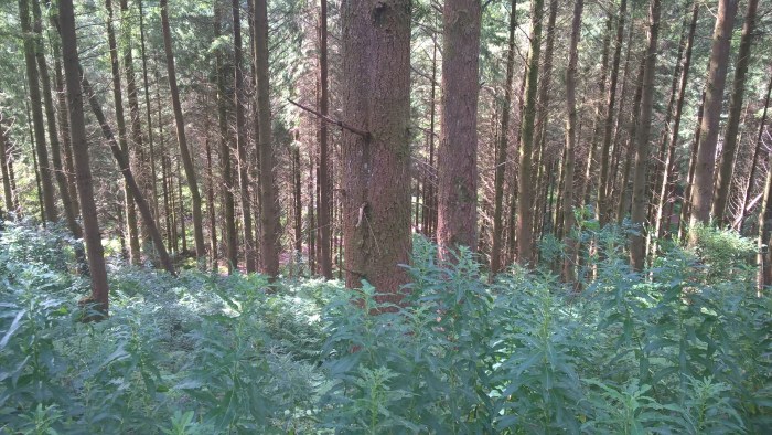
Follow the track deeper into the forest. Stand still for a moment to hear the water rushing below. Gaze out through the tall, straight pine trees.
Soon the trees open up, the sun shines through and you’ll come to another fork. Take the left hand fork which turns down hill, into the valley below.
The trail now takes you along the side of the valley and around the other side in a horseshoe shape. From here you have excellent views out across the trees below. The track becomes a little bumpier, you’ll definitely need an off-road pushchair for this section.
As you wander back down towards the river there is another junction. Turning left; this is where the forestry trail meets the accessible track that leads back to the car park alongside the river.
Due to a landslide we couldn’t reach the car park this way. However we did stop for a look at the river and the picnic area on the other side!
After resting our legs on the bench for a short while we turned around and headed back the way we had come through the forestry.
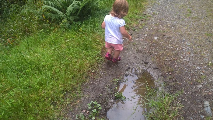
Our adventurer loved the long grass….
… splashing pine-cones into puddles…
… and clambering on rocks (we did check it was safe!).
When we reached the car-park we headed down into the picnic area…
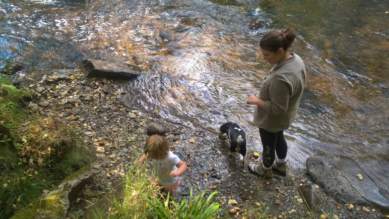
and into the river to cool off!
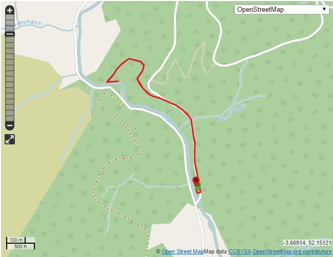
Use this map to guide you on your way. Click to enlarge.
Click on the map below to view on ViewRanger.
The OS grid reference is SO 851 509.
Pwll Bo is managed by Natural Resources Wales, more info on their website.
Directions: From Llanwrtyd Wells follow signs to Abergwesyn. The car park is around 3 miles along this road on your right. You will pass a picnic area (Washpools) but this is not where the trail begins, carry on a bit further!
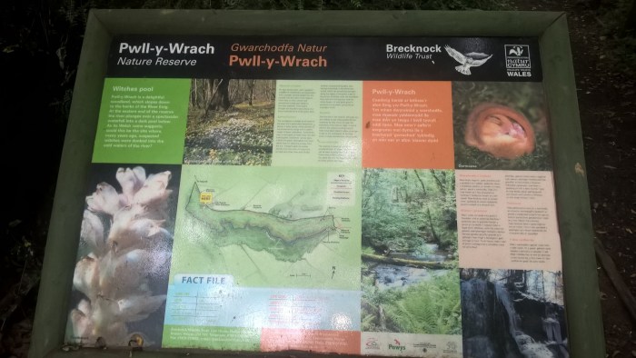
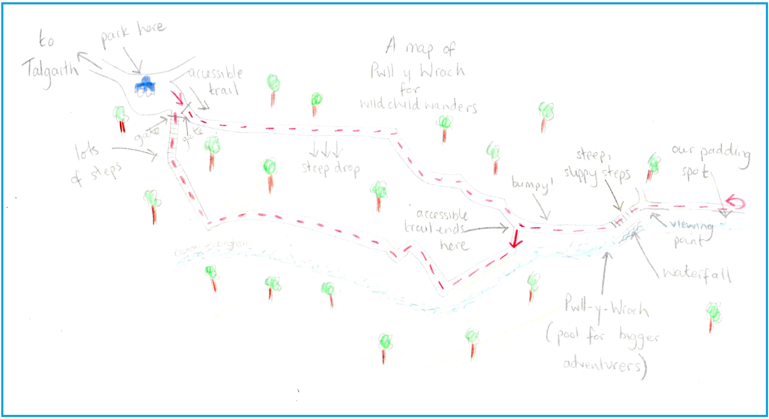
Pwll y Wrach is a watery, woodland wander with waterfalls, rocks for climbing and pools for paddling. It is sheltered in the trees so is great on a drizzly day or when you need some shade from the hot (?) sun. This reserve is well used and the paths are clearly defined but also quite muddy if it has been wet, so wear appropriate boots. There is onsite parking for around 3 cars and an accessible linear trail suitable for pushchairs as well as circular routes for on foot.
Pwll y Wrach (accessible linear route)
Distance: about 2/3 of a mile
Time: 15-20 mins if you don’t stop to play
Pwll y Wrach (circular route)
Distance: just over a mile
Time: 40 mins (1 and a 1/2 hours including splash stops)
Guide to Pwll y Wrach
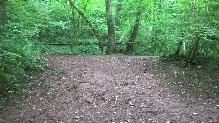
From the parking area you can see two gates. We went through the gate on the left which leads to the accessible trail.
Just through the gate is a useful information sign including a guide to the trails.
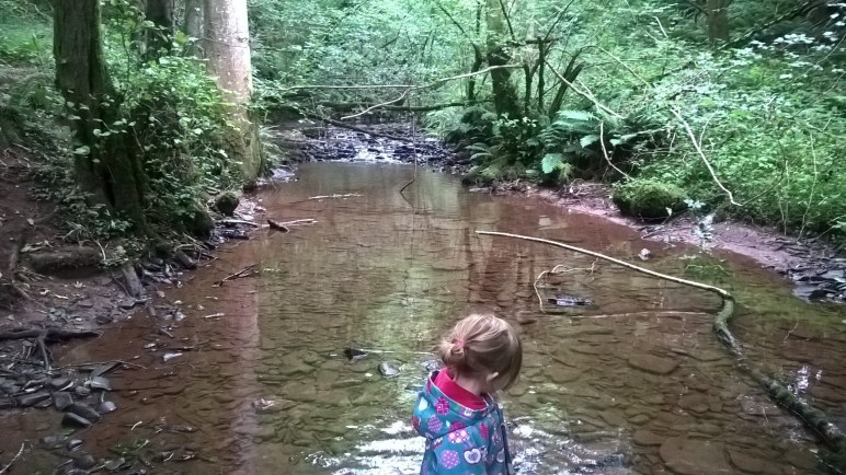
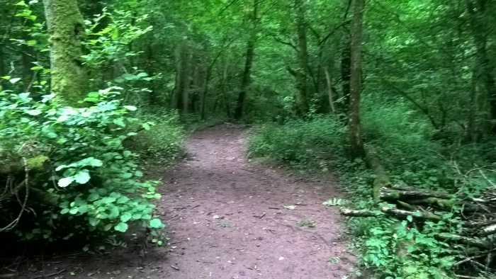
This section of the wander continues for around 1/3 of a mile. The path is wide and well-surfaced and our adventurer enjoyed being able to look across, down and up through the trees. Listen out for the water rushing below. We went on a hunt to “find the water.”
Please be careful as there is a steep drop in places and some rails are missing. There are signs to say that these will be replaced.
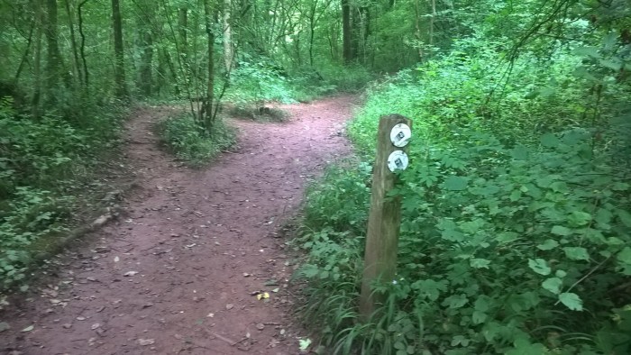
You will come to a junction with an information sign. This is where the accessible trail ends. Turn back here if you have brought wheels with you, after you’ve had a splash in the stream directly ahead of course!
We took the left hand turn towards the main waterfall and pools. The terrain on this track is muddy, slippy and rocky in places, your adventurer will probably need a helping hand to balance and steady themselves along here.
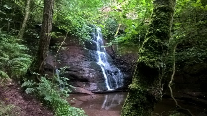
There are some fantastic views of the stream and you can hear the waterfall long before you catch sight of it through the trees.
The main waterfall and the pools beneath it, where the site gets its name from, are quite spectacular even in the summer when rainfall is less. Bigger adventurers might be brave enough to paddle or even swim here in the rocky pools, but it is too deep for little ones. (Don’t worry though, there’s lots of paddling to be had in a minute!)
After having a really good look and listen we carried on past the waterfall and up the steps beside it. The path was quite narrow and the steps steep. Little adventurers will definitely need a hand to reach the top.
At the top there is a viewing platform where you can see the water falling over the edge of the rocks. I imagine this is deafening in the winter!
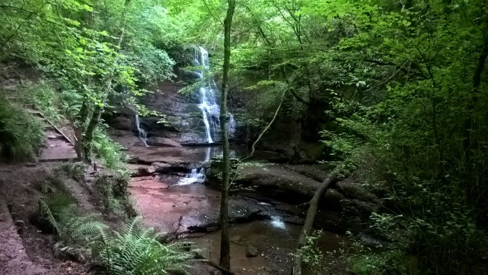
After this the trail forks…
…we took the right hand fork and wandered until we found a good place to access the stream in a place where the bank was low and the water shallow. We spent ages here, in and out of the water and up and down the bank.
A bit later we turned around and headed back towards the waterfall, stopping again to have a good look at the different plants at the edge of the trail.
We followed our footsteps down the steps next to the waterfall and back to the junction with the accessible trail. Pausing en-route to have a climb on some rocks (blurry action shots…).
At the junction we followed the trail straight ahead down the hill. If your adventurer has tired legs I would suggest returning along the accessible route to the right as there is bumpy terrain and steps to follow.
This part of the trail is at the bottom of a picturesque valley with a stream running alongside. More opportunities for splashing if required!
When you come to this junction (below) take the right hand trail.
And when you come to the next junction, head right, up the steps.
At the top of the steps you will find the parking area.
If your adventurer is likely to get tired legs I would suggest starting off by going through the right hand gate (at the car park) and heading back along the accessible path after visiting the main waterfall.
Use this map to guide you on your way. Click to enlarge.
Click on the maps below to view them on ViewRanger.
The OS grid reference is SO 165 326.
Pwll y Wrach (accessible)Pwll y Wrach
Pwll y Wrach is a Brecknock Wildlife Trust site and they have some great information on their website including a leaflet about the site and the following directions.
Directions: From the junction in the centre of Talgarth, with the Tourist Information & Resource Centre on your right, turn right. The road passes over the River Enig and then take the sharp left turn which leads into Bell Street. After 50 metres, turn left opposite the Bell Hotel and follow the minor road up a hill for about 1 mile. A short distance after the last houses of Talgarth, the main reserve car park and entrance is on the right where you will find an information panel.
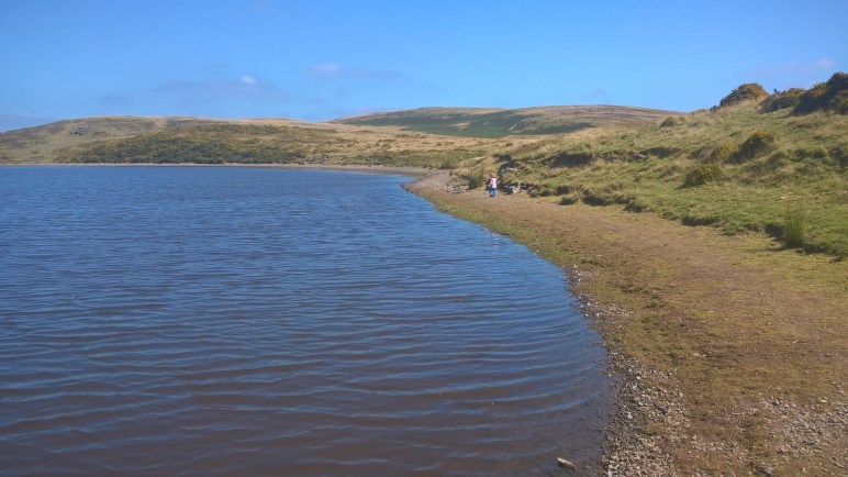
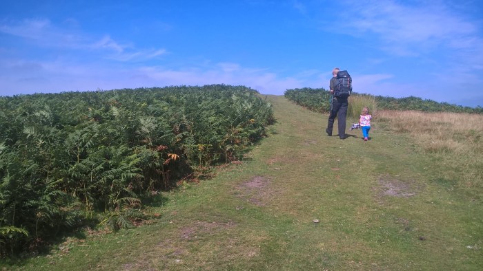
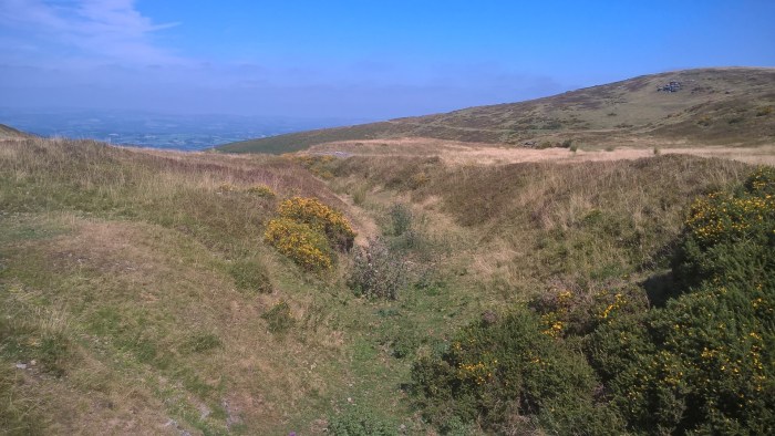
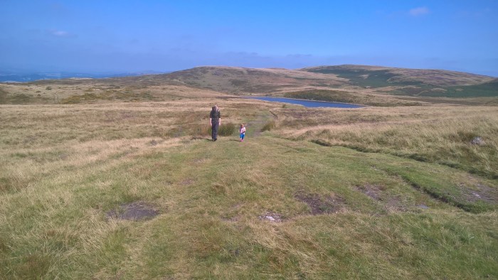
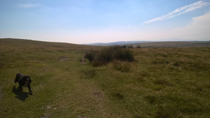
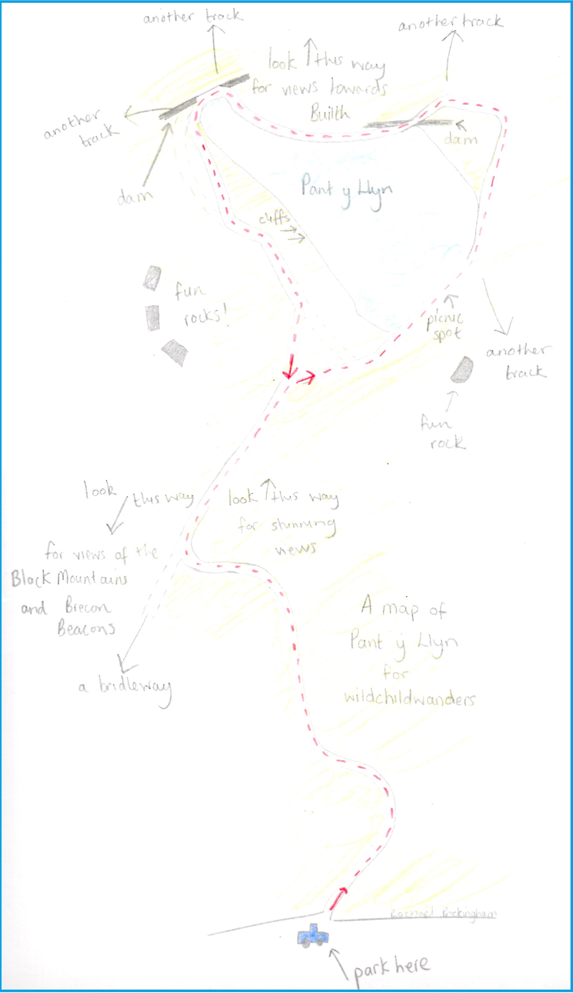
Pant y Llyn is a blustery, beautiful hilltop wander with spectacular scenery and far-reaching views. It is particularly open on this hillside and therefore windy, even on hot summer days, so dress appropriately and take layers. There is a small parking area on the roadside which is quite bumpy. This is a great wander to take a picnic on as you can sit by the, more sheltered, lake side and take in the views while you eat. If you are feeling very adventurous then take a map and extend your walk, you really could go for miles, remembering a carrier for your adventurer.
Pant y Llyn
Distance: just over 1.5 miles
Time: About an hour (it took us 1 hr 20 mins with a short picnic stop)
Guide to Pant y Llyn
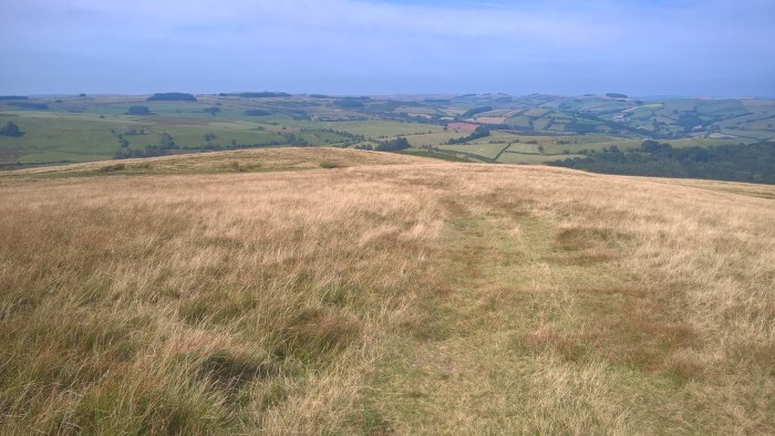
From the parking area follow the grass track and wander up the hill…
… around the corner…
… and over the brow of the hill.
Soon you’ll be able to see Pant y Llyn (the lake) on your right hand side, in the distance.
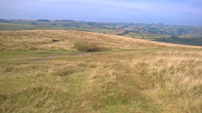
The grassy track curves around to the left and comes to a ‘T-junction.’
Turn right and wander down the hill towards the lake.
As you get closer to the lake there are a number of tracks. We kept right and wandered down to the shoreline.
Here we had a picnic and our adventurer loved standing on the rocks and looking into the water (with Daddy close by!).
We then followed the shoreline anti-clockwise, taking a small detour along a grassy track to avoid disturbing a fisherman. Our adventurer loved running up and down the small grassy banks.
When the weather has been dry there is a track all the way around the lake, however if you are wandering after the weather has been wet then you will need to walk higher up. Don’t worry, there are clear tracks, just keep the lake in sight so you don’t wander off-route.
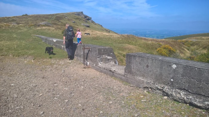
Soon you will come across a small concrete dam. On our wander it was dry, however if it is wet you can cross the stream slightly further down. You will need a good jump or wellies!
Now keep following the shoreline until you come to a second dam. Our adventurer had a fantastic time jumping, running and climbing on rocks.
After the second dam there are two tracks, the larger one on the right goes around the small hill and the smaller on the left goes up the hill. Choose whichever you feel is best, they join together at the top. We wandered left…
Follow this grass track until you come to a fork. The right fork takes you back down to the lake, going left will start to take you back.
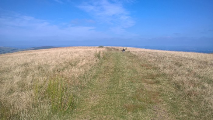
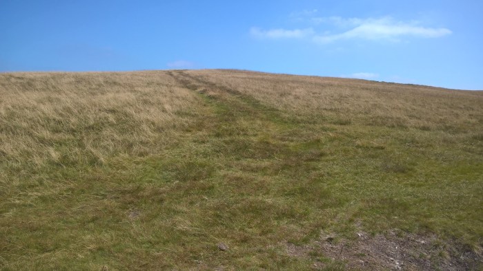
We wandered left and back up the hill that we came down earlier.
Whilst walking up this hill, take a moment to look back, it’s stunning!
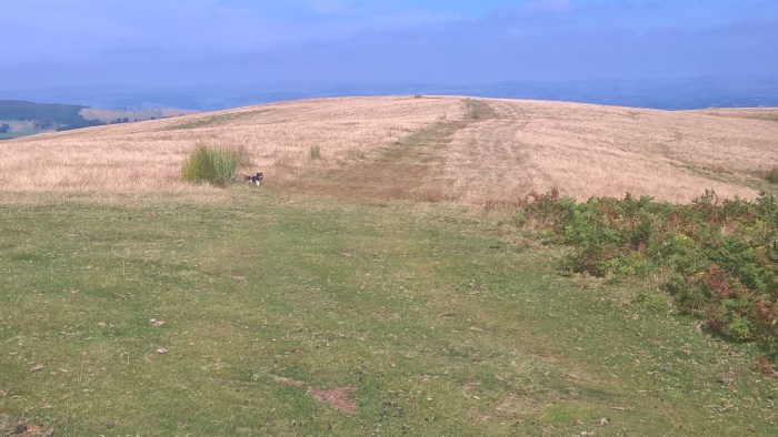
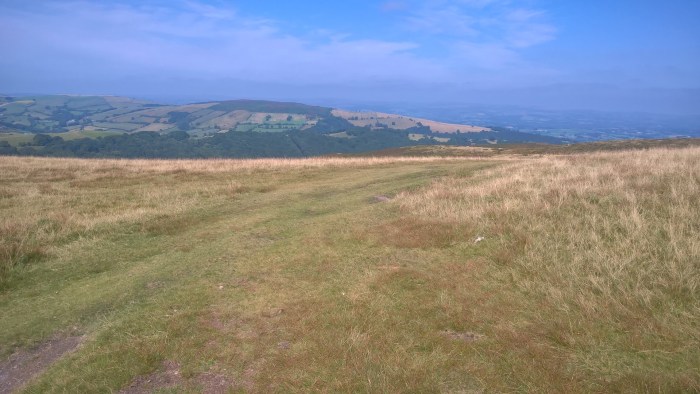
Follow this grassy track up the hill and around a corner where you have a spectacular view of Pen-y-Fan in the distance (unless it’s cloudy). Keep looking for the grass track that leads up the hill to your left.
Keep following this grassy track, up the hill, along the top and around a corner, and eventually you’ll be able to see your car in the distance – if you can drag your eyes away from the amazing views of the Black Mountains and Brecon Beacons on the horizon.
The terrain on this wander is pretty good for little legs however I would still take a carrier, or be prepared to rest, as the uphill sections on the way home seem like mountains after all the running about by the lake!
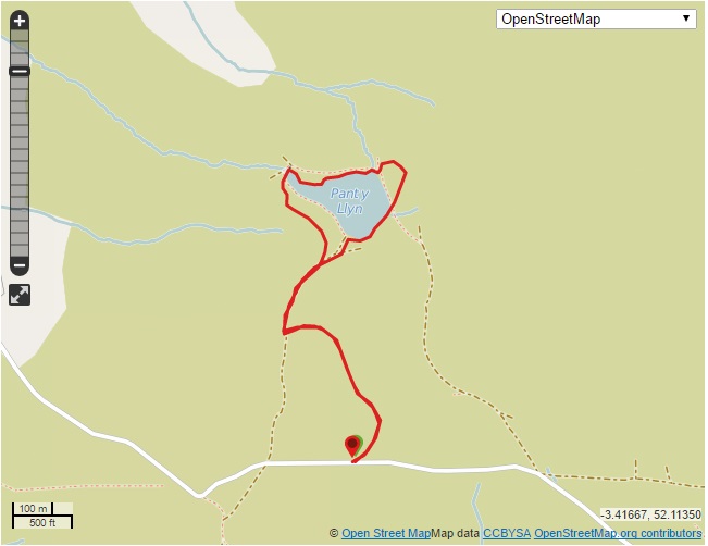
Use this map to guide you on your way. Click to enlarge.
Click on the map below to view it on ViewRanger.
The OS grid reference is SO 039 459.
This trail is located on common land to the south of Builth Wells, adjacent to Mynydd Epynt; it is not part of the military training area. The lake itself is managed by the Wye and Usk Foundation and you should contact them if you wish to fish.
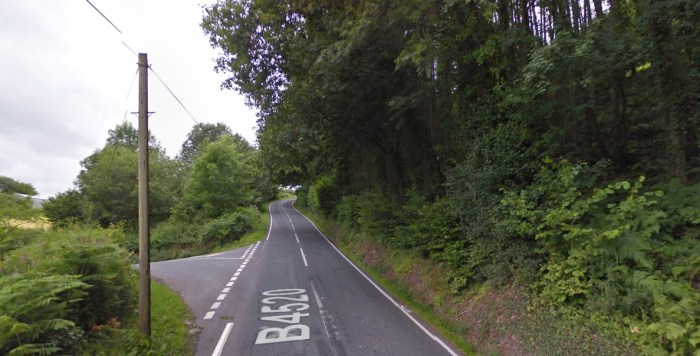
Directions: From Builth Wells take the B4520 (Brecon Road) towards Upper Chapel. After around 3.5 miles take a left hand turn (see pic below). There are sometimes signs advertising eggs for sale.
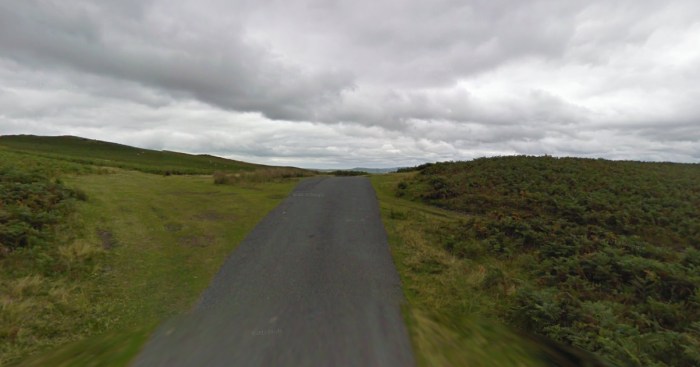
Carry on along this lane for about a mile, through a farm and out onto open hill until you come to this parking area on your left, on the brow of a hill.
N.B. there is a similar parking area just before this however it is not on the brow of the hill.
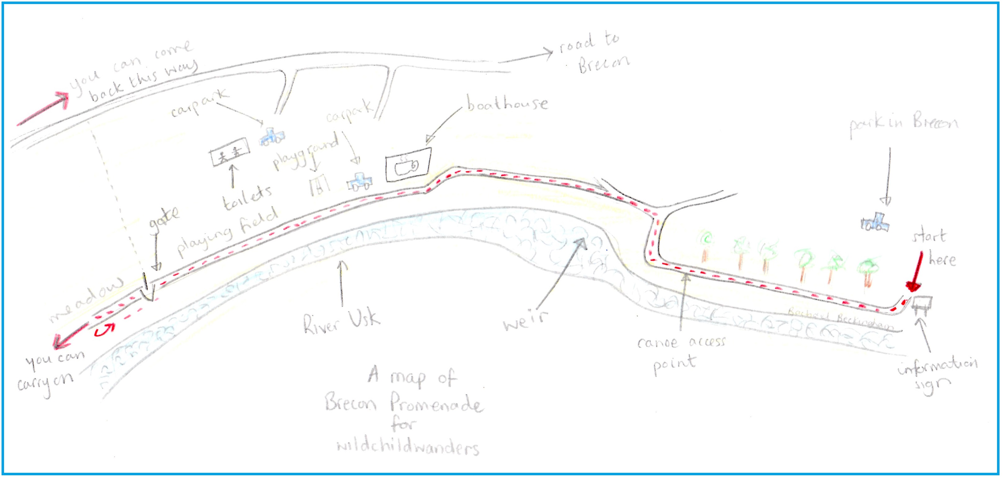
Promenade is a level linear wander that begins on a tarmac path in Brecon town centre, continues onto a level off-road pathway and then on to a bumpy footpath. It is low down next to the river, with views of the Brecon Beacons, and is a pleasant alternative to the hills if the weather is unpredictable. Pay and display parking is available in the town centre and at the Promenade car park further out of town where you can also find toilets, a cafe, playground and boat hire at the Brecon Boathouse. This wander can begin and end in a few different places so you can adapt it to suit your needs; a good choice if you are trialling off-roading with a toddler or new pushchair.
Promenade
Distance: 1.5 miles* if you walk in a straight line – around 2 miles with a wanderer
Time: 1 hour – it took us 30 mins extra as we wandered off route and stopped to explore.
*It could be from 1/2 a mile up to 3 miles depending where you choose to begin and end your wander
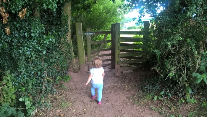
N.B.the footpath at the end of the walk is not suitable for pushchairs as it has a narrow kissing gate, alternative route available.
Guide
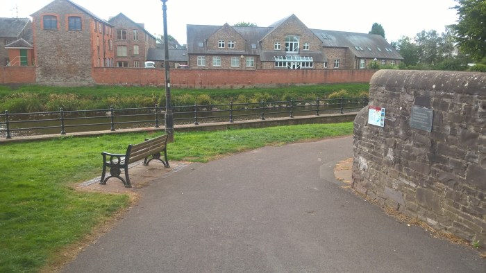
Follow the directions below to find the beginning of this wander, in Brecon town centre where the the Rivers Honddu and Usk meet. It looks like this…
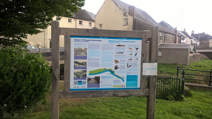
With an information sign to the left.
From here meander along the tree lined tarmac path with the river on your left. We wandered from tree to river and back again; you can see right down into the river but keep little adventurers close as they could make their way through the railings.
Please be aware that at the end of the railings there is an access point for canoes into the river.
The wander continues under some trees, around a corner and past a pretty spectacular weir.
Further along this path you will come to a fork, take the lower left-hand fork which will lead you down towards the Brecon Boathouse.
At the boat house you will find a cafe, a playground and boat hire. It is around half a mile along the Promenade to here and took us about 20 mins. There is a pay and display car park here too.
And toilets! These are a bit out of the way, across the playing field by an upper car park.
If you wander along the path next the the river it now changes from a tarmac pavement into a level grass track that runs alongside a playing field. There are some handy adventurer sized benches but also be aware that the river bank is close in places.
Our wander follows this track next to the river until it comes to a kissing gate. If you have a pushchair that will not fit through the gate you could make a circular walk by going around the playing field. It took us just over 30 mins to wander to here from Brecon town centre.
Through this gate the wander turns into a footpath. It is still level with a few bumps on a dirt track through the field. We wandered through the first field and then turned around as our adventurer had tired legs! However, this footpath carries on for around 500m through fields and arrives at a road that could be a circular route (see ViewRanger map).
This wander isn’t perhaps as off-road as usual for us but it is definitely worth a look if you are after an adaptable, more leisurely stroll with open spaces for your adventurer to run.
Use this map to guide you on your way.
Click on the map below to view it on ViewRanger.
The OS grid reference is SO 042 286.
This wander can be found in the Brecon Beacons National Park easier access guide and you can find more information about the Brecon Boathouse facilities here.
Directions: Finding the start of this walk proved a bit if a challenge for us! The route begins where the River Honddu and River Usk meet. Parking is available throughout Brecon town centre.
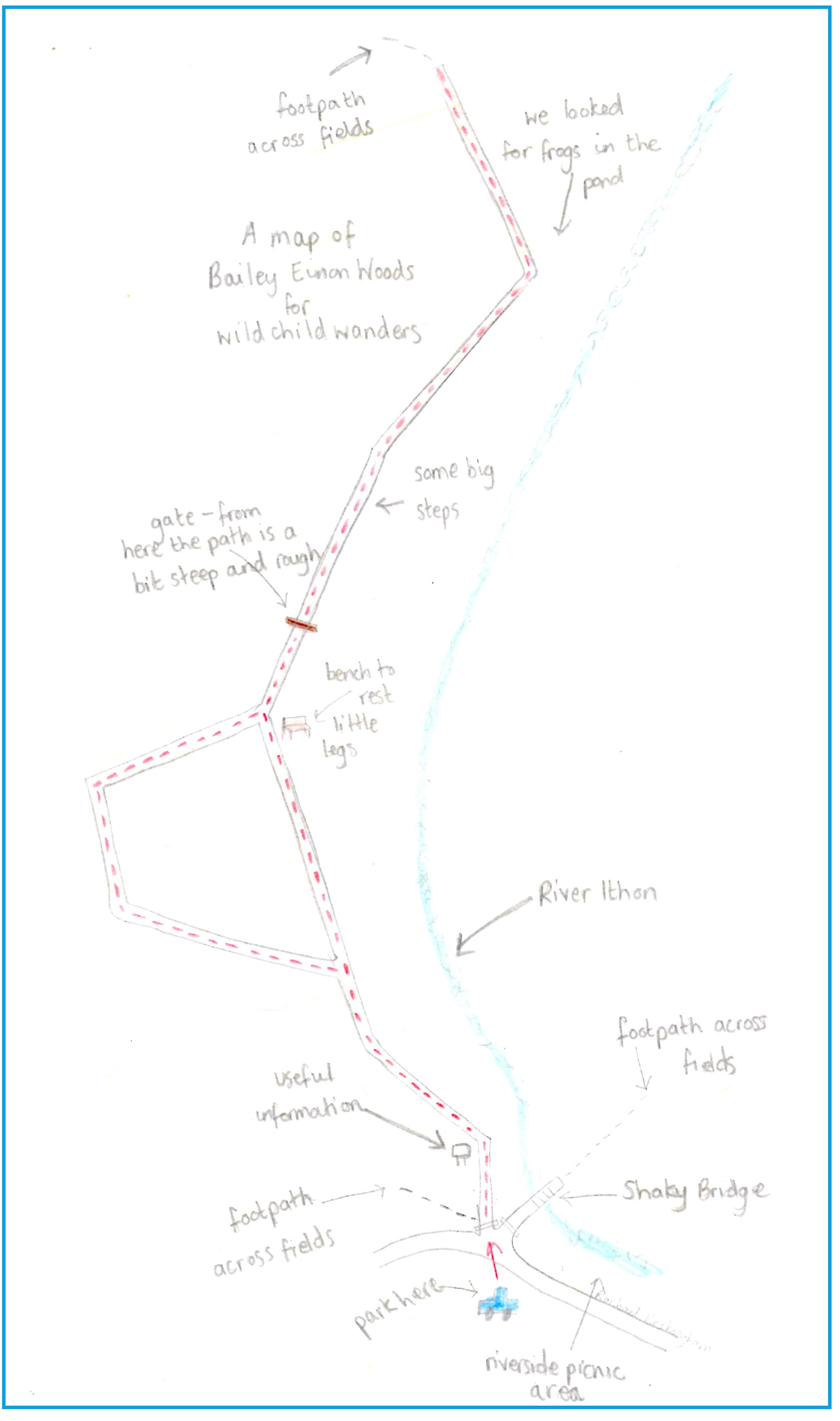
Bailey Einon is an up and down woodland wander, with a decent pathway, next to the River Ithon. It is sheltered by trees and is a good adventure to go on on a drizzly day – just make sure you wear sensible shoes as it could be slippy! There is lots of free parking just opposite the site entrance and an adjacent riverside picnic area. With both a shorter, easier loop and a longer trail this wander can be adapted to your little adventurer.
Bailey Einon (shorter loop)
Distance: just over 1/2 a mile
Time: Under 30 mins
Bailey Einon (longer wander)
Distance: just over 1 mile
Time: 40 mins (it took us an hour with a wanderer)
Guide to Bailey Einon
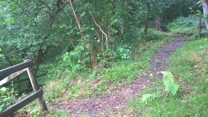
From the car park cross over the road and head left. At the edge of the picnic area you’ll see a large gate (access to Shaky Bridge) and a smaller kissing gate to the left. Go through the kissing gate and wander straight on into the woods.
The trail through these woods is very clear with fences, helpful steps and a board walk in damp places… so you really can’t get lost! There is also an information sign telling you about the woods and animals you might spot.
As you wander through the woods take time to look out for creepy crawlies on the floor, birds in the air and plants growing up the trees. It might be a good idea to take a magnifying glass or binoculars depending on the age and interests of your explorer.
After a short while you will come to a fork in the trail. This guide follows the lower, right hand fork across a bridge where you can watch the stream below.
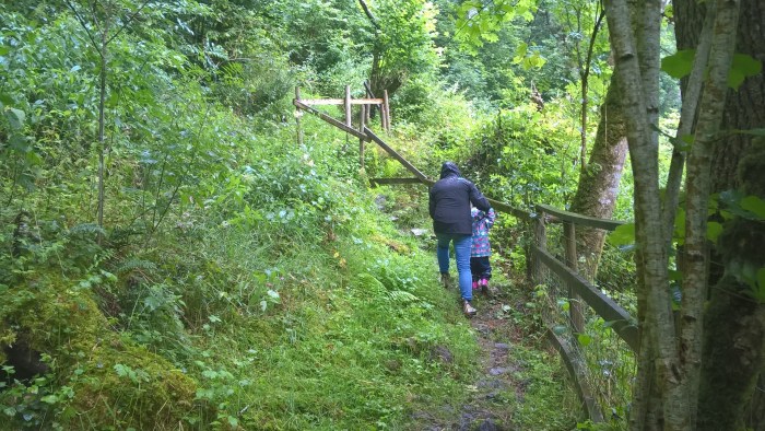
Next you will arrive at a lovely clearing with a bench to rest your legs. A good place for a drink after the uphill wander to get there. The view is pretty fantastic too.
Just after this bench there is another fork in the track. If you’re doing the shorter route then you will need to take the left hand fork, this will eventually come back out on the main trail (see map).
If you’d like to wander further then take the right hand fork.
The wander continues along boardwalk trails and over another great bridge with rushing water below.
After the bridge you will come to a gate across the path. Here it explains that the trail gets a little steeper and slippier beyond, your wanderer will almost definitely need a helping hand. Our wanderer loved jumping from one big rock to another holding mummy’s hand!
You are now heading downhill and the path runs alongside the river for a while. There is a fence between your adventurer and the river so you can let them wander without worry.
Further on there is a small ‘pond’ and lots of other places for looking for creepy crawlies. We spotted a tiny frog and then spent aaaaaages looking for more!
The trail now leads up a hill and comes to an end at the top. If you’re feeling extra adventurous (and have an OS map and a carrier for your wanderer) the trail does carry on as a footpath across open fields where you can eventually loop back around to the car park along a small road. Definitely plan this route in advance.
If you are following our trail then now is when you turn around and head back along the track by the riverside and up to the gate. To ensure this isn’t a completely linear walk, take the right-hand fork in the trail on the way back and add in a loop around the top of the woods (see map).
Once you are back through the kissing gate you can go back to the car park or rest in the picnic area with a snack.
Use this map to guide you on your way. Click to enlarge
Click on the maps below to view them on ViewRanger.
Bailey Einon Woods is a Radnorshire Wildlife Trust site and they have some great information on their website including a leaflet about the site which the following directions are taken from.
Directions: In Llandrindod Wells at the mini-roundabout on the A483, take the exit signposted for Welsh Assembly Government. Continue straight ahead for 1 mile. At the end of the urban area, bear right at the sharp bend heading uphill. Continue for approx 1½miles and you will see a Powys County Council sign by the Shaky Bridge picnic area. Park here.
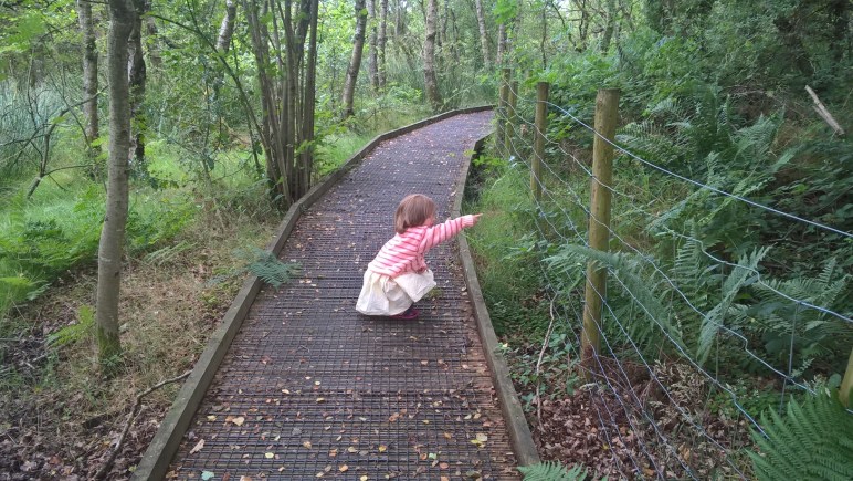
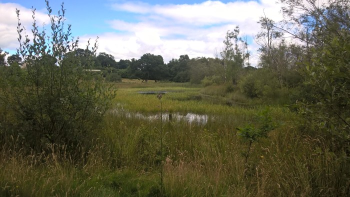
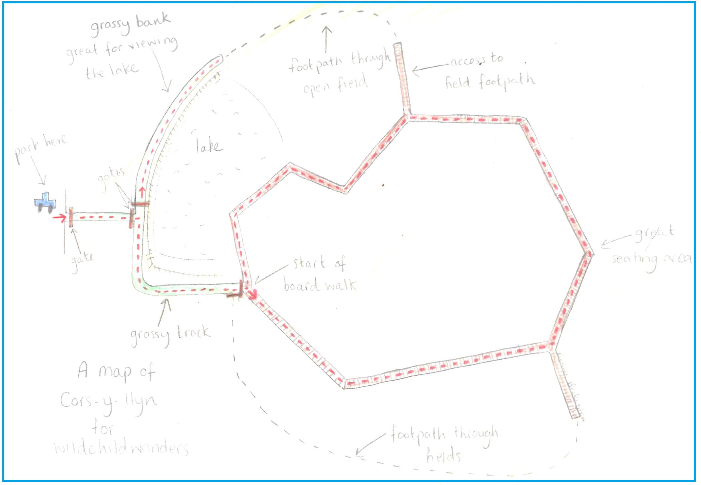
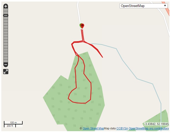
Cors y Llyn is a level, accessible nature reserve wander that consists of grass tracks and a well maintained boardwalk. It is quite open in places so dress for the elements if it is particularly windy or sunny. This quiet reserve is only a few minutes off the A470 and has free onsite parking, great for stretching your legs on a long journey. Our adventure took us around the boardwalk loop, however there are also two footpaths linked to the site that could make your wander longer and more varied. We have included these on our map for you to take a look; please note, they are not suitable for pushchairs.
Cors y Llyn (boardwalk trail)
Distance: just under 1 mile
Time: 30 mins – it took us 50 mins with a wanderer
Guide
From the car park walk past the information sign and go through the gate to the right hand side of the parking area. The gates on this site are suitable for use from a wheelchair too!
The first part of this trail is a grassy track which leads down to another gate.
Once you’re through this gate take the right hand track that will lead you around a lake area to another gate. This area is fenced off so little wanderers are safe to roam as they can’t get close to the water.
Next you will come to two gates. For the boardwalk take the left hand gate. The other gate leads to a footpath that can be followed to form another loop in your adventure, it goes through some bumpy fields (see map below).
Now you are on the boardwalk! This guide goes anti-clockwise. First you will wander through trees…
Then it becomes more open…
We had a fantastic time carefully touching the different plants that live at the edge of the bog and looking for wildlife. We saw a tiny frog and this amazing caterpillar…
There are a number of lovely seating areas around the boardwalk as well as passing places if you meet other families with wheels. Please be aware that you must stay on the boardwalk and not wander onto the bog.
When you complete the boardwalk circle your little adventurer may wish to go again, or you can head back around the lake towards the car park. At the next gate instead of heading straight home we wandered through the right-hand gate and onto the grassy bank.
This runs adjacent to the lake and is great for viewing any waterbirds that might be hiding – we saw a heron! This would be a wonderful place to have a picnic or sit down for a well earned rest. Please be aware that there isn’t a fence between the water and your little wanderer so don’t let them explore too close to the edge without an adult nearby. At the far end of this bank is a gate leading to a footpath, creating another short loop through an open field (see map).
Then finish your wander by strolling back to the parking area.
Use this map to guide you on your way. Click to enlarge.
First-nature have a super website with information about the Cors y Llyn from which I’ve taken the following directions.
Directions: If travelling from the north, you should drive through Newbridge on Wye and turn right onto the former A470 road immediately outside the village. This road now runs parallel with the new A470 road south towards Builth Wells.
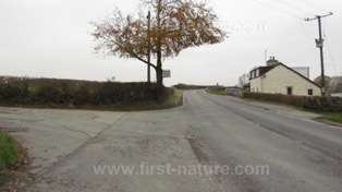
Continue along this road for approximately 2.5km (1.5 miles) and look out for an unsigned right-hand turn (pictured below) with a cream cottage on the left hand side of the road (as you drive south).
If approaching from Builth Wells there is a left turn off the new A470 road signed towards Cwm Bach Llechryd. This takes you onto the former A470 and the NNR is then a left hand turn opposite the cottage pictured above.
Turn into the narrow lane and continue along it about 400m (1/4 mile), passing through a farmyard, until you reach the end of the road. There you will find a parking area.
Water-Breaks-Its-Neck is a woodland walk with the added bonus of a waterfall and stream for lots of splashing! It is sheltered beneath the trees so is especially good when the weather is rainy or really hot. There is parking onsite and useful information signs. We have included both the short waterfall walk and a longer loop for the more adventurous wanderers in the step-by-step guide below.
Water-Breaks-Its-Neck (short waterfall walk)
Distance: 1/2 mile
Time: 20 mins if you don’t include time for splashing and exploring
Water-Breaks-Its-Neck (longer loop)
Distance: 1 mile
Time: 45 mins – it took us 1 hr 10 mins with a wanderer
Water-Breaks-Its-Neck
From the car park follow the track down the hill, past the information sign, and into the woods.
At the bottom of the hill you will come to a flatter, stoney area with a stream running through it.The path to the waterfall is on your left and runs down the right hand side of the stream.
We spent a lot of time splashing here, but be careful, some of the rocks are slippy for younger wanderers.
Follow the path next to the stream into the ravine with moss covered trees stretching up into the sky. Take some time to stand still and look up, the trees are pretty impressive.
As you turn a corner you see a wall of water and rocks standing in your way. Depending on recent rainfall you might hear the waterfall long before you see it. This wander took place on a damp summers day and we were able to walk right up to the waterfall. Our little adventurer loved putting her hands in the waterfall and watching the ‘bubbles.’
When you have finished exploring turn around and head back to the junction with the main track. As you approach you can see the stream entering a tunnel. We had a great time standing at either end and calling to each other.
On the opposite side of the track (where the tunnel comes out) is a lovely bridge and stream area, you might enjoy looking for trolls underneath it….
If you are doing the shorter walk, now is the time to head back up the main track to the car park, retracing your steps.
For those heading out on the longer loop, take the trail that forks off the path to the waterfall, heading up the slope (see map below if this is unclear). This part of the wander is a little steep and our wanderer required a hand to help her along.
You will come to a fork in the trail, take the left hand fork that seems to turn back on itself slightly. From here to the top of the slope is verysteep and slippy. Most wanderers will need some help or even picking up to get to the top.
There are some way-markers on the path up as other trails join on, keep going up, past a house on your right until you come to a fork. Take the left fork to head across the top of the waterfall.
This part of the path has a steep drop on the left hand side and does not have a fence, so keep your little wanderers close! You will walk over a bridge where the stream that feeds into waterfall flows under. Be careful here too, there is a steep slope on the right hand side of the path.
Now you will start wandering down a much gentler slope with a wider path through the trees and a fence on your left. This will take you all the way down to the main track just before the entry to the car park.
Use this map to guide you on your way. Click to enlarge.
Click on the maps below to view them on ViewRanger.
This trail is in Warren Wood which is maintained by National Resources Wales. They have some good information on their website.
Directions: From the New Radnor direction, after a mile look out for a brown advance warning sign for parking and information on your right. Turn here and go through the first parking area and follow the forest road uphill for Warren Wood car park.
Each wander that we share with you will be given a push, walk and carry rating depending on its suitability for pushing, walking or carrying your little wanderer. This should make choosing an off-road adventure to suit you a little easier.
Always remember that any activity is at your own risk.